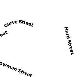
0 BUMSTEAD CT
Owner Information
DAHLQUIST CATHY R TRS
75 CLAIRMONT ST
LONGMEADOW, MA 01106


Property Details
0 BUMSTEAD CT is classified as a Undevelopable Residential Land.
0 BUMSTEAD CT is valued at $23,800. The land is valued at $23,800 and the structures are valued at $0.
This property is in Zone ResA. Confirm with local Zoning Board authorities to ensure there are no overlays or other easements on this property.
The most recent deed for 0 BUMSTEAD CT is recorded at the local registrar in Book 67911, Page 596. 0 BUMSTEAD CT was last sold on Tuesday, August 30, 2016 for $1.
Assessment data from fiscal year 2021.
Flood Data
According to the FEMA National Flood Hazard Layer, this property does not appear to be in a flood zone. It may also be in an area not yet reviewed. Nonetheless, confirm this information prior to taking any action.
To view the flood hazards around this property, create a FEMA "Firmette" Map of the area around 0 BUMSTEAD CT.
Broadband Internet Providers
| Provider | Type | Bandwidth (mbps) | |
|---|---|---|---|
| Starry, Inc. | Fixed Wireless | 200 | 200 |
| VSAT Systems, LLC. | Satellite | 2 | 1 |
| HughesNet | Satellite | 25 | 3 |
| Viasat Inc | Satellite | 100 | 3 |
| Verizon New England Inc. | DSL | 3 | 0 |
| Verizon New England Inc. | Fiber | 940 | 880 |
| Comcast | Cable | 1000 | 35 |
| GCI Communication Corp. | Satellite | 0 | 0 |
Broadband service provider data from December 2020.
Adjacent Properties
- 181 LEBANON ST
Single Family Residential owned by HILTZ THOMAS R - 0 BUMSTEAD CT
Undevelopable Residential Land owned by ARENA PAUL C TR OF THE - 10 WEBBER ST
Single Family Residential owned by FONSECA GUSTAVO - 165 LEBANON ST
Single Family Residential owned by CORNAY NIXON - 171 LEBANON ST
Two-Family Residential owned by HILTZ THOMAS R